
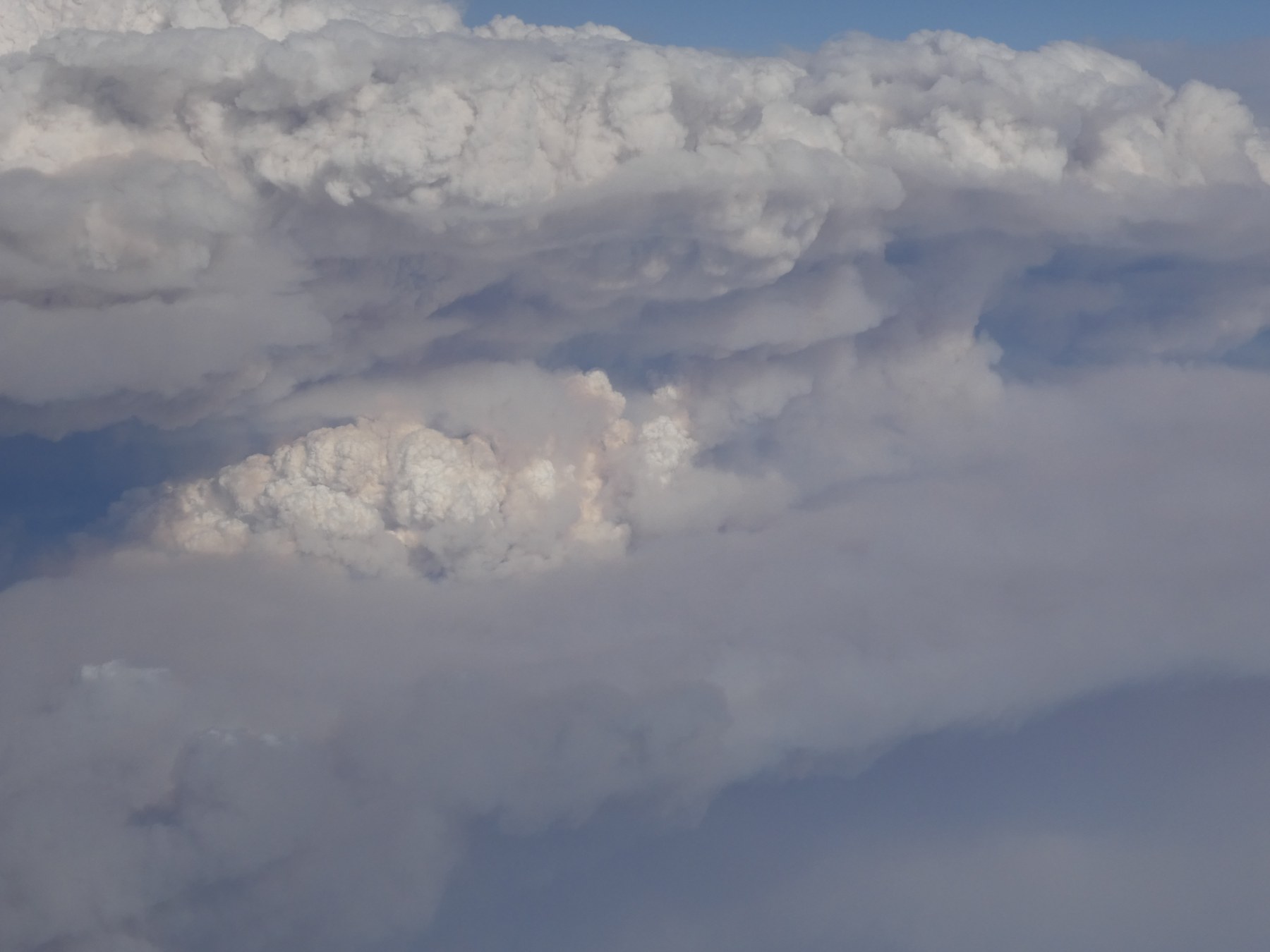
On August 26, a research aircraft sampled a thunderstorm produced by Idaho’s Wildhorse Fire. NASA described the summer encounter on October 2.[1]
The campaign investigated which fires push smoke into the upper atmosphere, and what happens to that material afterward. NSF NCAR’s project description connects the mechanics of a rising column with its effects on atmospheric composition and radiation, using observations inside the air and from above and below.[2]
A fire-generated thunderstorm, or pyrocumulonimbus, begins with heat rising from burning vegetation. As the plume climbs and water condenses, released heat provides additional buoyancy. Smoke helps supply the particles on which cloud droplets form; abundant small droplets can suppress rainfall. The resulting cloud can carry material upward while the circulation draws air toward the fire underneath. In the most dangerous cases, a blaze and its cloud become a coupled system, each affecting the other.[4]
That coupling changes the problem for people nearby. Lightning can start additional fires, while downdrafts and erratic winds can alter an existing fire’s spread. Hail and intense turbulence add other hazards. A towering smoke column is therefore more than a distant indicator of how much vegetation is burning. Its development can introduce a new set of weather conditions at the ground. Most smaller fire clouds do not grow into these deep thunderstorms, making the transition itself a crucial subject of research.[4]
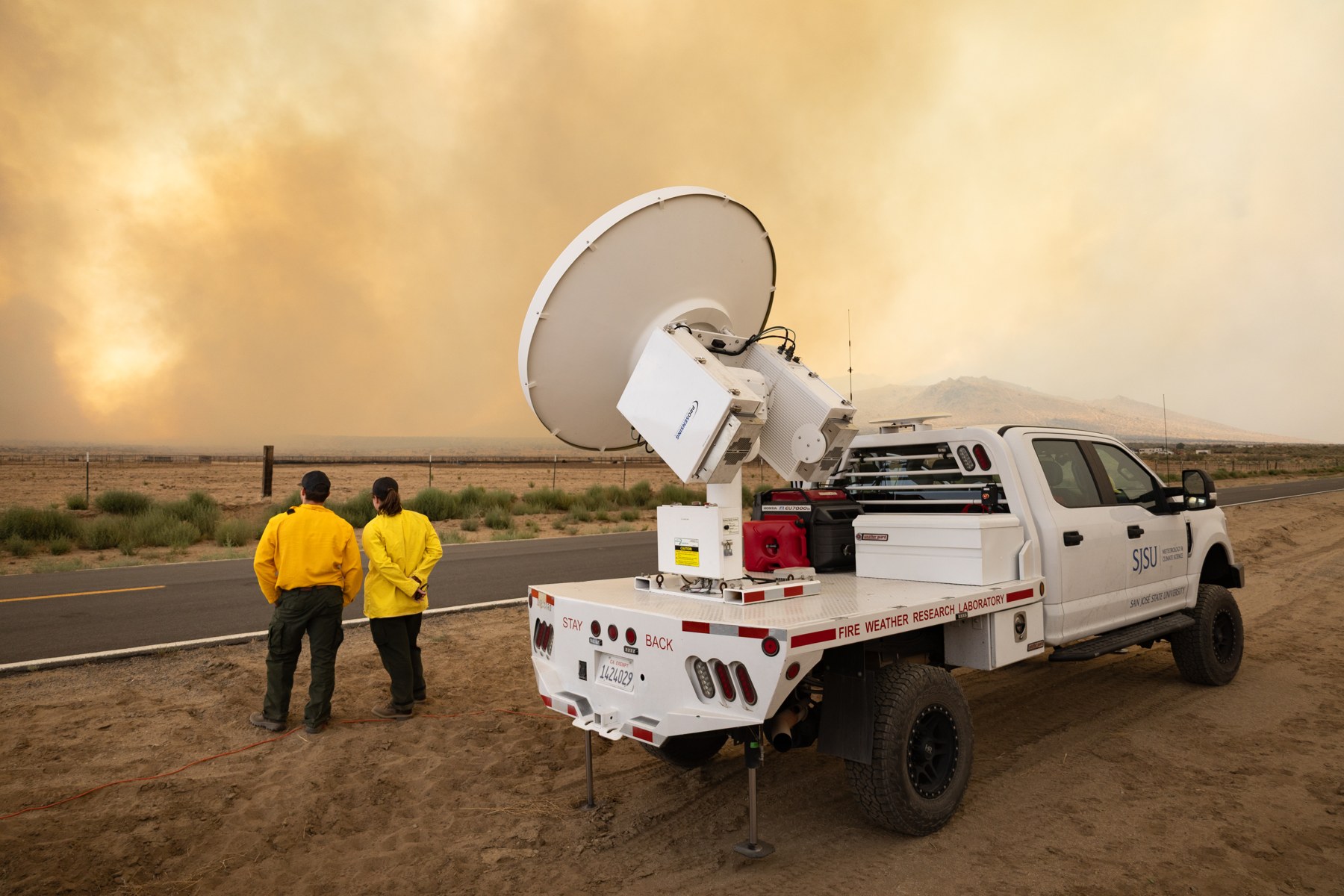
Image details
Proportionally resized and compressed; no crop, padding or content alteration.
The atmosphere has to cooperate
Forecasting that transition requires more than a prediction of hot, dry weather. Researchers at Australia’s Bureau of Meteorology developed an approach that asks how much heat a fire would need to supply in a particular atmosphere. Weather-balloon measurements or forecast models describe the temperature and moisture overhead. From those, researchers estimate the height a plume must reach and the buoyancy boost it needs to develop into a thunderstorm.[8]
Wind complicates the calculation. Stronger winds bend a column over, so more heat may be needed to lift it high enough. The bureau calls the calculated requirement the pyrocumulonimbus firepower threshold. Its account describes Australian trials in 2019 that helped forecasters identify periods of elevated threat. The method provides a way to assess a favourable environment; predicting the fire’s actual size and heat output remains another part of the problem. Conditions encouraging rapid fire spread and those supporting a rising storm column do not always line up.[8]
A study published in 2025 examined that environmental puzzle across southeast Australia. Researchers compared atmospheric profiles associated with fire thunderstorms and large fires that did not produce them, using events from 1991 through 2020. Thunderstorm-producing fires often occurred with hot, relatively dry air near the ground and moisture arriving at middle levels. Temperatures there fell steeply with height, favouring further ascent once cloud formed.[10]
The wind profiles also contained a distinction: the two groups looked similar at lower levels, but fire-thunderstorm cases tended to have weaker winds higher in the troposphere. There was considerable variation within the thunderstorm group, however. The study describes a family of environments rather than one compulsory sequence. Its regional scope matters, too. Patterns measured in southeast Australia help frame a forecast problem; they do not by themselves supply a universal threshold for every North American fire or landscape.[10]
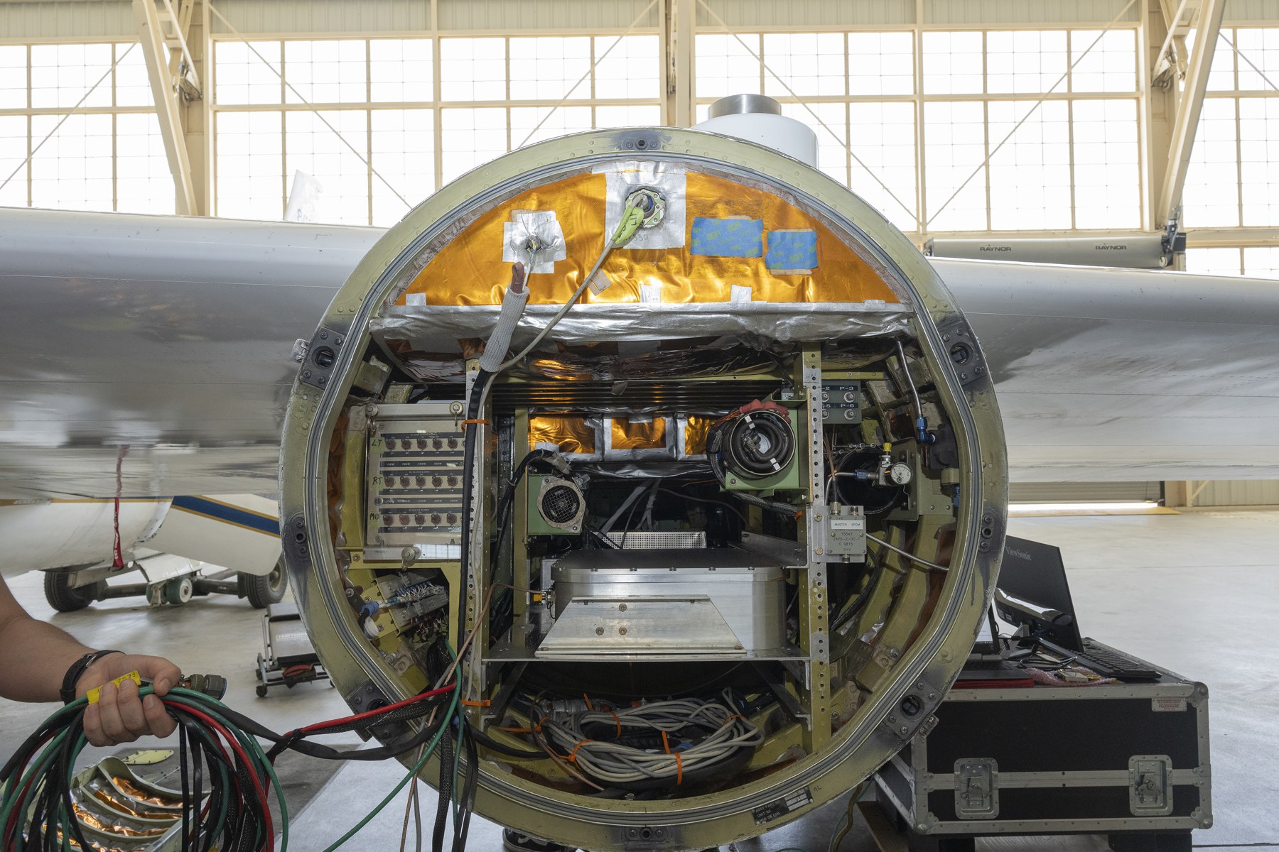
Image details
Proportionally resized and compressed; no crop, padding or content alteration.
INSPYRE combined NASA’s high-altitude ER-2, NCAR’s Gulfstream V and mobile ground instruments. The aircraft brought remote sensing, direct atmospheric sampling and radiation measurements; ground teams added scans and local observations. Matching those views with satellites and models could help connect a fire below with its cloud above. These are investigative tools and objectives, with conclusions still to follow.[2]
A smoke plume that outlives the fire
The scale of the possible consequences became clearer after an outbreak in western North America on August 12, 2017. Five nearly simultaneous fire thunderstorms injected an estimated 0.1 million to 0.3 million tonnes of particles into the lower stratosphere. A study published the following year compared that initial particle load with a moderate volcanic eruption. The clouds acted as routes across the boundary above the lower atmosphere, delivering a concentrated pulse of smoke into a region where it could travel far from its source.[5]
The volcanic comparison needs its boundary kept intact. The study compared initial particle masses, not identical chemistry or an identical climatic response. Volcanic sulfur dioxide can subsequently produce additional sulfate particles; smoke has a different mixture of ingredients. The 2017 event established how large a fire-driven injection could be while leaving the effects of its particular particles to further investigation. Even the mass estimate spans a factor of three, reflecting the difficulty of measuring a dispersed plume from remote observations.[5]
Australia’s Black Summer then supplied a larger example. An outbreak spanning late December 2019 and early January 2020 produced 38 observed fire thunderstorms, more than half of which carried smoke directly into the stratosphere. Researchers estimated roughly one million tonnes of particles reached that layer. Over three months, the resulting plumes spread around a broad portion of the Southern Hemisphere and continued rising.[6]
The duration was part of what made that outbreak distinctive. Intense activity persisted through some nighttime hours, extending the opportunity to send smoke upward. Researchers examining the event tied its evolution to the combination of fuel consumption, vigorous fires and atmospheric conditions. It widened the range of effects that scientists had to consider: a regional emergency could leave a high-altitude plume whose movement continued long after the most active burning. The study documents an exceptional outbreak; it does not establish that every severe fire season will produce the same result.[6]
Aircraft measurements have shown why following that aftermath is difficult. Joshua Katich and colleagues examined 13 years of observations for a 2023 study in Science. Their analysis attributed roughly 10–25 percent of the black-carbon and organic aerosols in the lower stratosphere to fire thunderstorms. That estimate concerns those particle categories and that atmospheric region, not a quarter of all pollution or of the entire atmosphere.[7]
One useful clue was the structure of individual particles. Smoke from the 2017 outbreak included relatively large particles with black carbon surrounded by thick coatings. Researchers could identify its influence months later, after dilution had made the original plume less obvious to remote instruments. In that setting, the contents of an air sample helped reveal a history that a conspicuous cloud no longer displayed. The finding explains the value of direct sampling alongside satellite observations: the visible boundary of a plume and the persistence of its material need not disappear together.[7]
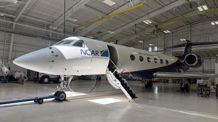
Image details
Proportionally resized and compressed; no crop, padding or content alteration.
Counting events, measuring consequences
The particles can also participate in atmospheric chemistry. A 2023 Nature study led by Susan Solomon proposed that mixtures of organic material and sulfate in wildfire aerosols make hydrochloric acid more soluble, helping activate chlorine that can destroy ozone. The researchers tested the mechanism by comparing model simulations with observations after the Australian fires. Their simulations reproduced several observed changes in chlorine compounds.[11]
The resulting estimate was a 3–5 percent loss of total-column ozone at southern middle latitudes associated with that chemistry. It was a regional result tied to the 2020 event. The proposed mechanism also enlarged the Antarctic ozone hole in the model, but did not account for its record duration that year. Those qualifications matter when connecting smoke to ozone recovery: the study identifies a consequential chemical pathway and a reason for concern, while leaving other processes involved in a particular season’s outcome.[11]
A broader inventory published in September 2025 recorded 761 confirmed fire thunderstorms worldwide from 2013 through 2023. Its busiest year was 2023, with 169 events globally, including 142 in Canada. More than half the full inventory injected smoke within one kilometre of the tropopause—the boundary between the troposphere and stratosphere—or higher. Reaching that neighbourhood is not the same as every event penetrating deep into the stratosphere.[9]
The estimated particle masses varied across four orders of magnitude. That spread is a warning against treating the number of fire clouds as a complete measure of their atmospheric effect: their size and injection height matter as well. The inventory’s authors present it as a foundation for a longer record with which to investigate trends. A record year supplies an important observation, but a stronger long-term account requires consistent detection, enough years for comparison and attention to regional variability.[9]
From measurements to warning time
The practical work now includes turning the summer’s observations into usable data. NASA’s MASTER instrument archive labels the INSPYRE campaign complete and lists 19 processed flights and 290 tracks, while noting that Level 1B processing is underway. Flight records are evidence that observations were collected and are being prepared. They do not establish that a forecasting improvement has already been validated. The useful test will be whether the measurements let researchers explain events more reliably and assess their methods against further observations.[3]
Sources & further reading
Original reporting and research behind this article.
- NASA campaign explores clouds spawned by wildfiresSource dated 2026-10-02; checked October 4, 2026
- NSF NCAR: INSPYRE field project and scientific objectivesProject record checked October 4, 2026
- NASA MASTER: INSPYRE 2026 flight and processing archiveProject record checked October 4, 2026
- Understanding the critical elements of the pyrocumulonimbus storm sparked by high-intensity wildland fireSource dated 2022-10-17; checked October 4, 2026
- Wildfire-driven thunderstorms cause a volcano-like stratospheric injection of smokeSource dated 2018-08-20; checked October 4, 2026
- Australia’s Black Summer pyrocumulonimbus super outbreak reveals potential for increasingly extreme stratospheric smoke eventsSource dated 2021-07-13; checked October 4, 2026
- Pyrocumulonimbus affect average stratospheric aerosol compositionSource dated 2023-02-24; checked October 4, 2026
- Bureau of Meteorology: predicting fire-generated thunderstormsSource dated 2020-03-02; checked October 4, 2026
- Worldwide inventory reveals the frequency and variability of pyrocumulonimbus and stratospheric smoke plumes during 2013–2023Source dated 2025-09-24; checked October 4, 2026
- Atmospheric profiles associated with pyrocumulonimbus in southeast AustraliaSource dated 2025-11-04; checked October 4, 2026
- Chlorine activation and enhanced ozone depletion induced by wildfire aerosolSource dated 2023-03-08; checked October 4, 2026
THE DAYBREAK / THE MORNING LETTER
A little more understanding,
every morning.
The day’s selected stories, the context behind them, and a deeper read. A considered start to your day, delivered to your inbox.
See what’s inside