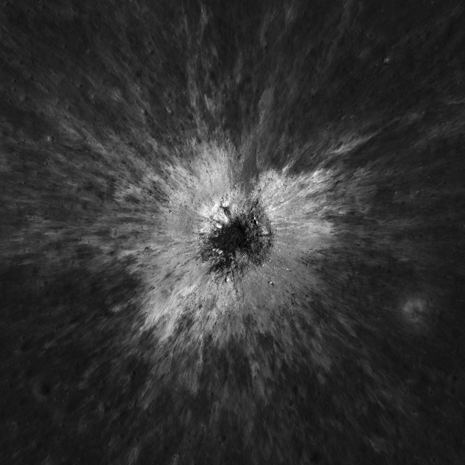
NASA described new research Wednesday on McGetchin crater, a 728-foot-wide scar formed between April 11 and May 22, 2024. Robert Wagner found it in October 2025 while comparing lunar maps. Follow-up thermal measurements revealed a four-mile-wide region roughly 16 degrees Fahrenheit colder at night than surrounding ground. Researchers attribute that difference to impact-disturbed soil that retains less heat.[1]
The striking result is the mismatch in scale. The visible cavity occupies a small part of the affected landscape. A camera can outline the crater and its bright surrounding deposits, while a thermal instrument tests a different property of that terrain. Together, the observations reveal change that would be easy to understate by drawing a circle around the hole.
Two ways to look at the same ground
The Lunar Reconnaissance Orbiter Camera system combines two narrow-angle cameras with a wide-angle camera. Its instrument fact sheet describes a tradeoff between detail and coverage: the narrow-angle cameras can resolve half-meter-scale features from a nominal altitude of 50 kilometers, while the wide-angle camera covers a much larger swath in multiple spectral bands. Actual image scale depends on the observing geometry and altitude.[2]
The mission’s original camera objectives included landing-site assessment, mapping illumination, measuring topography, characterizing loose surface material and investigating impact hazards. Observing terrain from different angles helps reconstruct its shape. A broad survey and a detailed follow-up therefore serve complementary purposes within the same instrument system.[2]
A before-and-after comparison also has a time resolution. If a feature is absent in one usable observation and present in another, those observations establish an interval in which it formed. They do not by themselves supply the exact moment of impact. Likewise, a close-up taken months later records the resulting terrain, with the lighting and viewpoint of that later pass.
NASA reports that scientists estimate impacts of this magnitude occur roughly once a century or less often across the Moon. That is a frequency estimate, not a schedule. The new findings were presented in two Science Advances papers; the impact itself is more than two years old.[1]
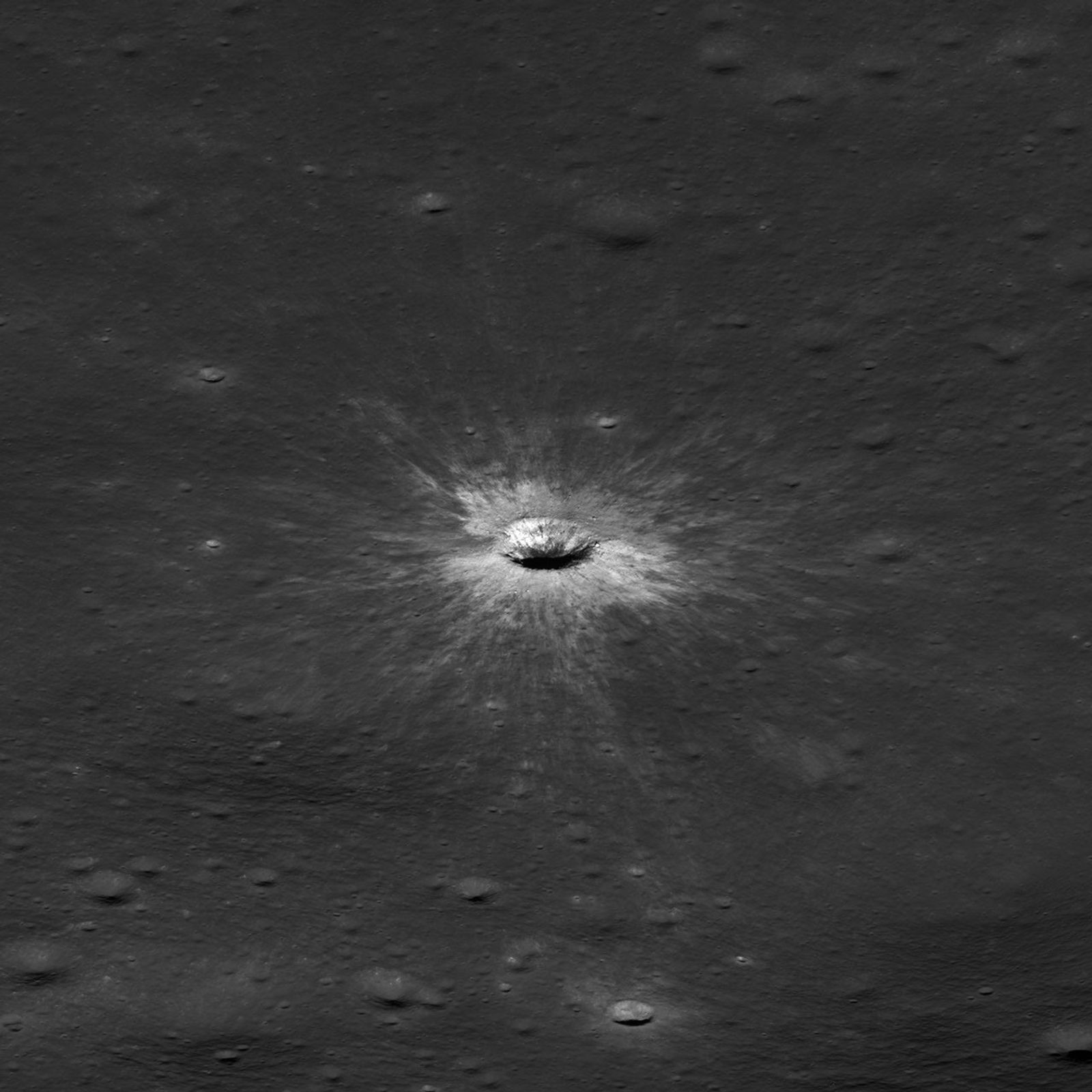
Image details
Resized proportionally and encoded as JPEG; no retouching.
What the night reveals
Diviner, LRO’s radiometer, maps temperatures during lunar day and night. Its team explains that the Moon’s near absence of an atmosphere and long day-night cycle produce extreme surface temperature swings. Temperature also varies below the surface: Apollo measurements showed very low thermal conductivity in the uppermost regolith and much smaller daily variations at depth.[3]
These properties make temperature a clue to structure. The Diviner team distinguishes calibrated measurements from derived products such as thermal inertia and rock abundance, which require models and other information. Thermal inertia describes resistance to changing temperature. A surface that warms and cools differently can thus indicate a different arrangement or mix of material, even when an ordinary image gives little indication of that difference.[3]
The interpretation depends on keeping observation and explanation connected. A colder nighttime patch is measured evidence. The physical description of what produced that patch is an inference tested against the measurements. Neither step can be replaced by the visual drama of a fresh crater. Brightness, shape and heat retention are related properties with different observational requirements.
The operational implication is a question for future surface exploration: how should a vehicle treat terrain whose physical properties have changed beyond an obvious obstacle? Orbital observations can identify places worth examining. They cannot substitute for direct measurements of wheel traction or soil strength at the site. A thermal boundary should not automatically be drawn as a proven hazard boundary.
The broader scientific value lies in having a landscape observed repeatedly by different instruments. A map becomes a record of change when another map follows it. A photograph becomes more informative when temperature measurements accompany it. McGetchin offers an unusually clear example of how a relatively compact impact can leave a much wider physical signature.
Sources & further reading
Original reporting and research behind this article.
- NASA: newly documented McGetchin crater and cold spotSep 16, 2026
- LROC instrument team: camera system fact sheetReferenced Sep 17, 2026
- UCLA Diviner team: lunar temperatures and data productsReferenced Sep 17, 2026